
Holywell Hill [Cnoc an Tobair]
Good walks are even better shared.
Overview
Holywell Hill [Cnoc an Tobair]
Introduction
Holywell Hill, known in Irish as Cnoc an Tobair, is a charming Marilyn located in the picturesque County Down, Northern Ireland. With its modest height of 201 meters, it's not the tallest in the land but certainly shrouded in natural beauty and local lore. This hill is like your friendly neighbourhood giant - welcoming and accessible!
Geology
The geology of Holywell Hill is quite fascinating, composed mainly of sedimentary rocks from the Silurian period. Greywacke and mudstone form the backbone of the hill, revealing remnants of ancient geological processes. As you ascend, take a moment to marvel at the distinct rock formations and feel the history beneath your feet!
Routes
A popular route to the summit begins from the C406 road. This moderate trek stretches about 2.5 km and can typically be completed in around 1.5 hours. It’s fairly straightforward but don't forget to bring your sense of adventure and perhaps a snack - we hear it's the secret to reaching summits!
Summit Features
At the top, you'll find a quaint stone cairn that serves as a great backdrop for a selfie. There’s also a viewfinder that helps you identify notable landmarks in the far distance. It's certainly a good way to convince your friends that hiking brings you closer to the stars!
Terrain Type
The terrain consists of grassy slopes accompanied by rocky outcrops, with a few boggy spots to keep you on your toes. A good pair of walking boots is recommended so you can navigate the terrain comfortably and gracefully.
Views
Once at the top, prepare to be awed. The Mourne Mountains and rolling hills of County Down greet you with open arms. And if you're lucky enough to have clear weather, the Irish Sea sparkles in the distance, ensuring that your heart (or your Instagram) overflows with beautiful captures. Spring and early autumn are the optimal seasons for enjoying these breathtaking views.
Hazards
Always keep an eye out for rapidly changing weather conditions in this corner of the world. Less-than-optimistic rain clouds could craft the perfect recipe for a slippery descent. Oh, and don't be surprised if you have to negotiate some sheep traffic along the way! They’re the true locals after all!
Nearby Summits
If you've got a spare day or want to expand your horizons, nearby summits worth a visit include Cranmore Hill and the towering Slieve Donard, giving trail enthusiasts plenty of options to explore.
Access
Access is easy with parking available along the C406 roadside, and for those relying on public transport, there’s a bus service to Newcastle, where you can find the nearest town full of amenities.
Facilities
In Newcastle, you'll be spoiled for choice with cafes, eateries, and public toilets to prepare you before or after your trek. Refuelling is key, especially if you've hiked up an appetite!
History
The name Holywell Hill indeed pays homage to its local significance, translating to 'Hill of the Well.' It serves as a reminder that, historically, such places were pivotal for communities. This hill has been a hub for locals, steeped in stories and rich in cultural significance.
Conclusion
In conclusion, Holywell Hill offers an accessible escape into nature with beautiful views and fascinating geology. Whether you're looking for a morning stroll or a deeper dive into local history, this remarkable hill won’t disappoint!
Explore routes near Holywell Hill [Cnoc an Tobair]
Public walks starting within 80 km of this hill. Nearby does not mean a route reaches the summit; check its map and access before setting out.
Derry~Londonderry City Walls Circuit
View route
Banagher Glen and Forest: complete higher-return circuit
View route
Portballintrae to Giant's Causeway: railway path and Blue Trail return
View route
Peatlands Park Red Trail: Annagarriff Wood and Derryadd Lough
View route
Route planning notes
These notes describe possible approaches, not verified navigable routes or permission to cross land. Check current paths, local access rules and conditions before setting out.
C406 Road Approach
A well-trodden route that begins near C406, this approach allows for a moderate hike with lovely views.
Make a day of it, together
Find someone to share the walk with, or organise a day out along a route you like.
Hill facts and local notes
Classifications
Elevation
260m
853 ft
Prominence
246m
Coordinates
54.9999, -7.3992
C385171
OS Map
07
At the Summit
The summit is marked by a small stone cairn, offering a perfect spot for a well-deserved rest and snack break. There is a fantastic viewfinder that helps orient the surrounding landscape.
Terrain & Geology
The hill primarily consists of sedimentary rocks, predominantly greywacke and mudstone, formed during the Silurian period around 425 million years ago. The landscape features a mixture of gentle slopes and steep inclines, revealing fascinating evidence of past geological processes.
Views & Scenery
From the summit, daredevil hikers can catch stunning glimpses of the Mourne Mountains to the south and the rolling hills of County Down. On clear days, the shimmering waters of the Irish Sea are also visible.
History & Heritage
Name Origin
Cnoc an Tobair translates to 'Hill of the Well', alluding to the historical significance of water sources in local folklore.
Historical Significance
The hill has been a popular site for local gatherings and has deep connections to the spiritual beliefs of the surrounding area.
Getting There & Facilities
Check current local access restrictions, parking rules and transport timetables before travelling. These notes do not confirm public access to the summit.
Parking
Parking is available at the C406 roadside, with just a short walk needed to access the trailhead.
Public Transport
The nearest bus station is in the town of Newcastle, with connections available from Belfast.
Nearby Facilities
In Newcastle, you can find numerous cafes, restaurants, and public toilets to refresh before or after your adventure.
Safety Information
Known Hazards
- Beware of sudden weather changes typical of Northern Ireland, which can make trails slippery. It's advisable to keep an eye out for roaming sheep; they may not yield much of the right-of-way!
General Safety Tips
- Check weather conditions before setting out
- Carry appropriate clothing and equipment
- Let someone know your planned route
- Take a map, compass, and GPS device
- Carry emergency supplies: food, water, first aid kit, torch
Hills
Some common questions about the hills answered
Are there group walks up Holywell Hill [Cnoc an Tobair]?
Many walkers use Walkmates to join or organise walks with others. You can check for group walks around Holywell Hill [Cnoc an Tobair] through the maps
Are there other walkers around Holywell Hill [Cnoc an Tobair]?
Activity varies by location and time, but Walkmates lets you see whether others have shared walks or shown interest in this area. Find other people through the walking friends search walking friends for Holywell Hill [Cnoc an Tobair] search or of course create your own walk for Holywell Hill [Cnoc an Tobair]
Can I organise a walk to Holywell Hill [Cnoc an Tobair]?
Yes. If there aren’t any walks listed already, you can create a walk and make it available for others to join.
If you're signed up to Walkmates, you can create a walk to Holywell Hill [Cnoc an Tobair].
How do I find a walk up this hill?
There are often multiple ways to walk this hill, depending on experience and route preference. Walkmates helps you explore walks and routes that others have shared.
Can I suggest a new route up Holywell Hill [Cnoc an Tobair]?
Yes. You can suggest or create routes to share with others. Walkmates focuses on the social side of walking, so routes are used to help people organise walks and explore areas together, rather than as detailed navigation tools or route libraries.
Other uses really appreciate knowledgeable walkers sharing their routes. Share your favourite route to Holywell Hill [Cnoc an Tobair] here
The is an error or something incorrect about this hill. How do I let you know?
We always strive to keep the information on Walkmates as accurate as possible. If you find an error, please let us know through the contact form and we'll aim to correct it as quickly as possible
Community Discussion
Comments
Location
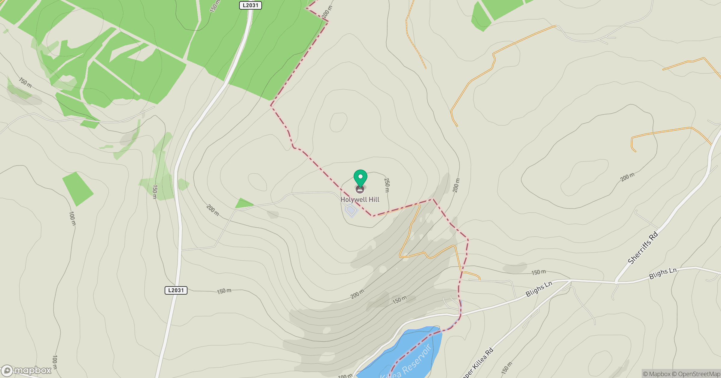
Grid reference: C385171
View on OpenStreetMapOpens a map in a new tab, centred on the hill.
Hills within 30 km
Straight-line distance, not a walking route or confirmation of access.
No comments yet. Be the first.